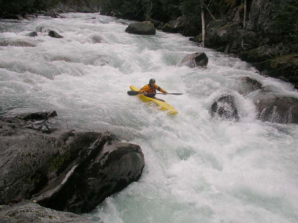
Waterfall at the start of the Cheakamus run.
Upper Cheakamus River
GAUGE: Cheakamus River on the BC river data page. This gauge is located at the take-out making it easy to check levels on the staff gauge once you arrive at the river. Flows are generally in the range of 2.2 to 2.8 during the summer which is ideal, with 2.5 being a good moderate level. Note that the character of the river changes dramatically with relatively small changes in the level. Locals often omit the two when reporting levels so "five-two" would actually be 2.52.
SEASON: A midsummer classic.
ACCESS: Nearest town: Whistler (Yahoo map). Take Highway 99 to Function Junction just south of Whistler. At the light, take Cheakamus Lake Road east and in 0.5 km (0.3 miles) you will reach the bridge across the river. After crossing the river take the left fork for the Westside Main Road. After making this turn head into the House Rock Day Use area to your left. This day-use area provides convenient parking for the take-out and you can walk down to the river and view the gauge. To reach the put-in continue up river left on the Westside Main Road (continue past the sign marking the "kayak put-in"). It is 3.0 km (1.9 miles) up this road to a small parking area at the Riparian Trail parking area (space for a couple cars) where the road comes close to the edge of the river.
Description: The Upper Cheakamus is a great run just a few minutes outside of Whistler with a long summer season. It provides non-stop class IV action all the way from start to finish. First timers might consider the higher volume creek boat, but experienced paddlers will enjoy this run in playboats. It is a short run that you can easily paddle in an hour or less if you know the lines making it a popular evening run with locals. Those headed down the first time will likely want to spend more time scouting some of the drops or go with a guide who can give you the lines as you go.
The river starts right off with a class V waterfall newly formed following recent floods which shifted the channel over a section of resistant bedrock. It's an impressive sight as you can still see evidence of the old channel, now plugged with rocks and debris, on river right. Those who just came for the class IV run put in below the waterfall (hike downstream on the trail about 100 m) but it does get run.

Waterfall at the start of the Cheakamus run.
The river begins immediately with fun whitewater leading into Cobra a great drop with a clean line that snakes back and forth across the river starting right, heading left, and then finishing off to the right. Fun class III/IV action continues to Down Under which is the drop beneath the suspension bridge (this is where the hiking trail crosses the river). A good line starts right above the bridge, heads left, and then skirts back right below the bridge. After you pass the bridge you will want to stop at a good eddy on river right before committing to the next horizon line. Triple Drop is below you and this is the spot where most who have problems on this run get into trouble. If it's your first time you will likely want to hop out and hike downstream to have a look and potentially set safety. The first drop is relatively straightforward but you want to be lined up correctly for the second drop which has a particularly sticky hole at the base. A narrow tongue skirts it on the left and as long as you didn't have any troubles in the first drop it's not difficult to hit (much easier if you have had a chance to scout the line from shore).

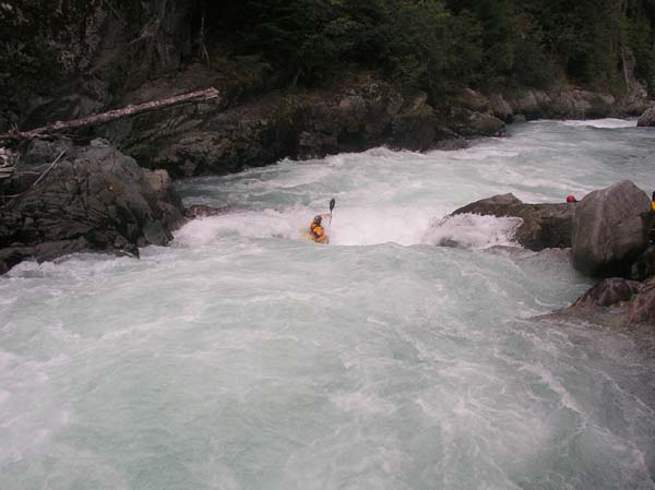
Lining up for the frst drop in Triple Drop.

The crux move: skirting the hole to the left in the second drop of Triple Drop.
The action continues with more fun continuous whitewater and a couple more distinct drops. Beware of Bush's, a large hole that extends across much of the river but offers sneaks to either side. As you reach the take-out the final major rapid is House Rock. A midstream boulder sends the flow rushing around to the left and right. The right side is a relatively straightforward line. Just after finishing House Rock rapid you will see the cable that crosses above the river at the gauging site. Pull out at the gauge on river left and walk up the bank to your car.
Additional Information:
Check out descriptions in the following guidebooks which you can purchase through the AW virtual bookstore.

Whitewater Trips for Kayakers, Canoeists and Rafters in British Columbia